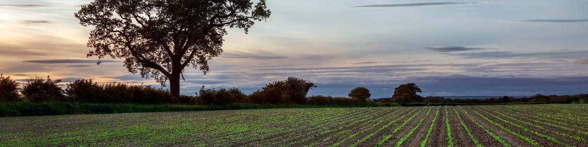

Here we give you some idea of the plentiful options open to walkers in the Slingsby area. You can now explore a different corner of the area each month with Geoff’s Walk of the Month.
Walks are currently available to download in Microsoft Word document (.doc) and Adobe Reader (.pdf) file formats ( files generally under 250 KB). From October 2020 onwards Geoff’s walks will be available in the PDF format only.
Also check out more of Geoff’s walks on the Slingsby Local Walks page.

Most computers will open PDF documents automatically, but you may need Adobe Reader
[If need be, you can use our Village Plan to orientate yourself in Slingsby.]
Walk for April 2024 | Slingsby Banks Wood, Hall Moor, Fryton Woods. A short walk through peaceful woodland. Can be muddy. pdf
Walk for March 2024 | Fryton West Wood. A short walk through peaceful woodland, away from traffic. Can be very muddy in places. pdf
Walk for January/February 2024 | Hovingham, Moor House Farm, Hovingham Lodge, Mill Wood, Hovingham Park. Starting with a steady climb to good views, through woodland and farmland, then returning along a beck to Hovingham Hall. pdf
Walk for December 2023 | Terrington, High Stittenham, Low Mowthorpe. A walk that starts and ends in the Howardian Hills Area of Outstanding Natural Beauty but ventures into the contrasting flat Vale of York to the meeting of the Ebor and Centenary Ways. Fine views and plenty of peace and quiet. pdf
Walk for November 2023 | Oulston and Husthwaite. A quiet 5 mile walk with good views. pdf
Walk for October 2023 | Bulmer, Mowthorpe, Brandrith. A pleasant and interesting short walk. pdf
Walk for September 2023 | Ampleforth Moor and Studford Ring. A strenuous walk combining paths and tracks through peaceful woodland with some panoramic views. pdf
Walk for August 2023 | Coulton Circular Walk. pdf
Walk for July 2023 | Coneysthorpe and Castle Howard Monuments. A compact walk around the perimeter, without paying. pdf
Walk for June 2023 | Welburn, High and Low Gaterley, Castle Howard’s monuments. A walk that offers real tranquillity and some excellent views. The route is quite hilly with one steep ascent out of Crambeck, and can be very boggy in parts. There is something of interest most of the way including some familiar Castle Howard landmarks in the latter part of the walk. pdf
Walk for May 2023 | Butterwick. A peaceful walk through flat countryside by the River Rye with lots of wild birds. pdf
Walk for April 2023 | Kirkbymoorside, Ravenswick From the bustle of Kirkbymoorside you are soon n open country. You pass the site of the former Ravenswick Hall, now replaced by an impressive new development which includes the largest Stately Home to be built in Yorkshire during the last 200 years. You’ll find ancient woodland, awash with wild garlic in Spring, and get a glimpse of a fragment of the old castle. pdf
Walk for March 2023 | Sinnington and and Appleton-le-Moors. Two lovely villages, peaceful woodland and open farmland are all included in this walk which is shaped for much of its length by its proximity to the River Seven. There are some strenuous upward stretches, and in all but the driest weather there will be muddy sections so don’t try this walk in trainers. pdf
Walk for February 2023 | Swinton, Broughton, Hildenley Wood. Undulating countryside, lovely views, peaceful bridleways, ancient paths through deciduous woodland. pdf
Walk for January 2023 | Coneysthorpe, Centenary Way, Park Farm, Bog Hall. This route passes through some of the finest parts of the Castle Howard Estate and the views, especially over the Vale of Pickering, are tremendous. pdf


More walks and bike rides from locations in the Howardian Hills including Nunnington, Hovingham and Terrington can be downloaded from the howardianhills.org.uk website
The Visit Ryedale website also has some downloadable cycling routes HERE
Several walks centred on Ryedale market towns are also listed on the Visit Ryedale site and can be found HERE. They can be downloaded for free onto a mobile device, with GPS, maps and pictures.


Discover more from The Slingsby Village Website
Subscribe to get the latest posts to your email.